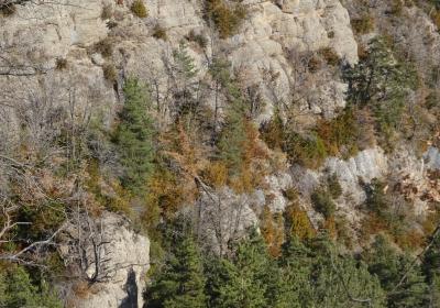
This is a typical Pre-Pyrenees stage that allows you to discover beautiful landscapes and solitary spots with lots of charm. The first half of the stage is quite demanding: first you negotiate Cingles de Capolat along the narrow ravine of Salt de Sallent and then climb to the highest part of Els Tossals mountain. During the second half of the stage you go along the ridge of the Els Tossals mountain -a stretch that offers extraordinary views! - and descend towards the hill of Pla de Cal Sant, Rasa de la Frau and the neighbourhood of Sant Lleïr, in Vall d'Ora.
Considerable. Due to the distance and ascent to overcome.
No special equipment needed.
Regional map of Catalonia 1:50,000 Berguedà-14. Geological and Cartographic Institute of Catalonia (ICGC).
Vall de Lord - Port del Comte 1:25.000. Edició 2015. Editorial Alpina.
You begin the fourteenth stage of the GR 1 at the crossroads of the C-26 and BV-4131, in (1) L'Espunyola (0:00 - 800m). Follow the white and red GR signs and cross the town (W), jumping over the little stream of Montclar. Open and close a large gate that seems to lead into the garden of a house and exit via a path that leads once again to the C-26. Cross the road and keep going, alongside some fields until you reach the church of Els Sants Metges and the cemetery. Here you begin the demanding climb to Cingles de Capolat. You switch between stretches on a path, which climbs in a series of twists, and some steeper stretches, that are taken on an old livestock path.
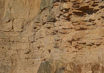
The ascent is quick, with the spectacular ravine of Salt de Sallent on your left. You arrive at a point where you cross the stream and continue along a path that passes the Mas de Comamorera and that keeps going up until Pla de Cal Penjarella, where you will find the ruins of the house of (2) Cal Penjarella (1:45 - 1.272m). You keep heading north. You go around the small town of Capolat on a paved path, until you take a trail. This is where the ascent to Els Tossals mountain begins, this is the second series of crags that we have to overcome during this stage, and that you can see just ahead (N). You walk through oaks and boxwood trees, first through the Serrat de Les Greixes and then up a hill. Finally, you arrive at a (3) hill (2:20 - 1.401m), on the crest of Els Tossals mountain.
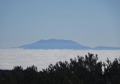
On this hill you change direction (SW) and flank the Serrat de Runers on its south side. Soon you will come to a narrowing that seems to be impassable: The Mal Pas de Runers. You should take care not to slip on the stones and fall from the precipice. Once you have overcome this stage, the route has no technical difficulties, you should need to take care not to venture too close to the edge of the cliffs. During the following stage the spectacular panoramic views that you have on both sides of the mountain of Els Tossals are marvellous: Taga, Puigsacalm, the mountain of Bellmunt, Collsacabra, the Plana de Vic, Montseny, Montserrat, the Central Depression, Montsec, Port del Comte, Pedraforca, Queralt, ...
You reach the (4) hill of Bosc de Casòliba (3:20 - 1.401m), a point where you begin to descend following the ridge of the mountain (SW) while you enjoy views over the mountain of Montsec, the fascinating Pla de Busa and the impressive Roca de Canalda. Below, you can now see the scattered houses of Taravil. You pass several detours until you come out onto the extensive (5) hill of Pla de Cal Sants (4:10 - 1.290m). Ignore the access route to Taravil (E) and follow the plain towards its western side. You then head into a majestic forest of red pine with undergrowth comprise of boxwood and juniper trees. You reach a point where the path begins to drop in altitude along the Serrat del Grau. You are heading into the wild and deep Rasa de la Frau. You will do some zigzags and head to the western slope of a secondary ravine. At this point you leave Berguedà behind and enter Solsonès.
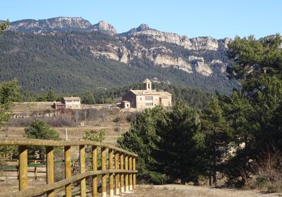
First, you head north and then go west. You join up with a path and undertake the last downward stretch towards the hermitage of (5) Sant Lleïr (5:20 - 765m), the epicentre of the bucolic Vall d'Ora and the end of this stage.
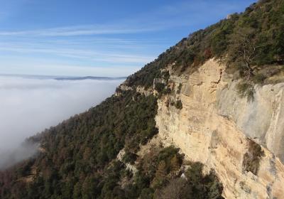
Walking up the picturesque ravine of Salt del Sallent through Cingles de Capolat.
The unbeatable views to be enjoyed from the mountain of Els Tossals.
The salvage and shaded Rasa de la Frau, which seems as if it swallows you towards the centre of the earth.
Admiring the spectacular Cingles de Busa illuminated by evening sunlight.
Vall d’Ora was the setting where the four bars become the emblem of the Catalan nation? This is where, in 897, the troops of Llop Ibn Muhammad, a lord from Lleida, took on those of Wilfred the Hairy, the count of Urgell, La Cerdanya, Girona and Barcelona. Following victory, the Muslims, the French King Charles the Bald drew the four bards on the golden shield of Wilfred the Hairy with the blood of the count himself, who was mortally wounded during the battle. A monument erected less than 100m from the hermitage of Sant Lleïr marks the exact place where, according to legend, these events took place.
Visiting the Vall d’Ora Ecomuseum. You will discover the history of this valley and understand the vital importance of the river Aigua d'Ora in its development. The force of the water powered windmills, sawmills and ironworks that, in some cases, remained active until the 1980s. From the old school, you cross a beautiful Romanesque bridge over the river, you will come to the sawmill and the mill of Ca l’Ambròs, that have been restored and are open to the public. Various well-structured panels help to provide a broader range of information.
On days when there are strong winds you need to be pay close attention on the most exposed stretches of the crest of Els Tossals. In winter you have to be careful during the descent of the Rasa de la Frau, as there may be icy stretches.


